Bay Area 1998 Weather Map
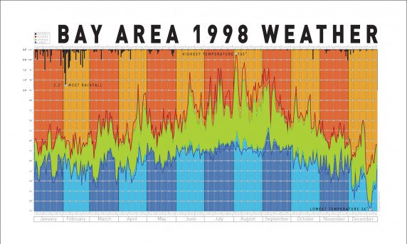
Role: Research, Creative DIrection, Information Design Project: A large 19″ x 22″ visualization map of all the weather on every day from 1998 in the.
Read More →Let us make your mark!


Role: Research, Creative DIrection, Information Design Project: A large 19″ x 22″ visualization map of all the weather on every day from 1998 in the.
Read More →