


Bay Area 1998 Weather Map
Role: Research, Creative DIrection, Information Design
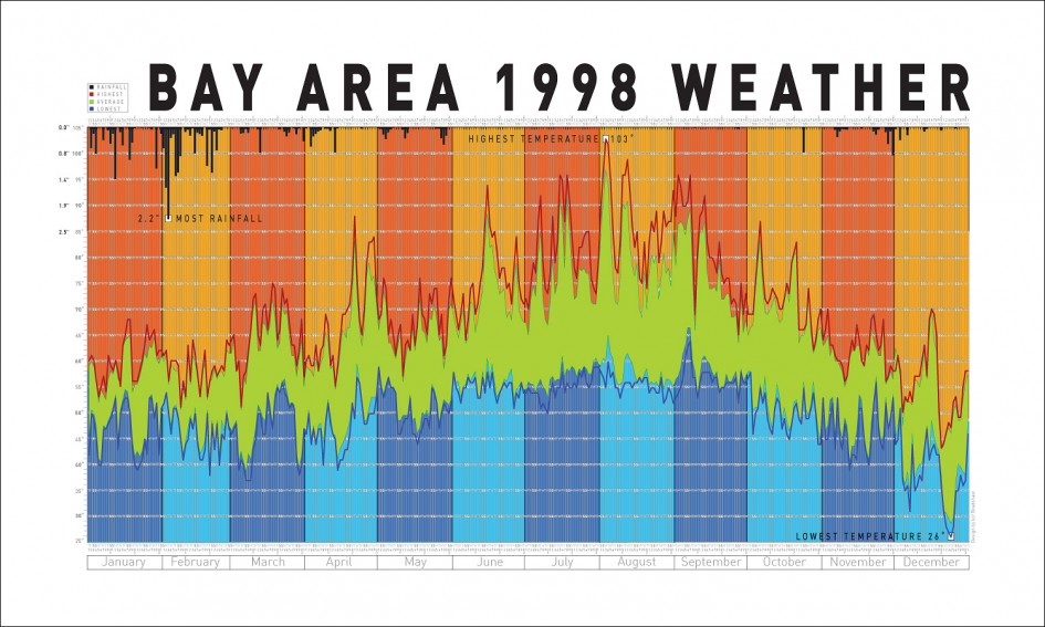
Project: A large 19″ x 22″ visualization map of all the weather on every day from 1998 in the San Francisco Bay Area. Includes rainfall (in black), highest temps (in red), lowest temps (in blue), and averages (in green)—and must be viewed full-size to be appreciated completely.
Download the full size map (2.8MB PDF)
